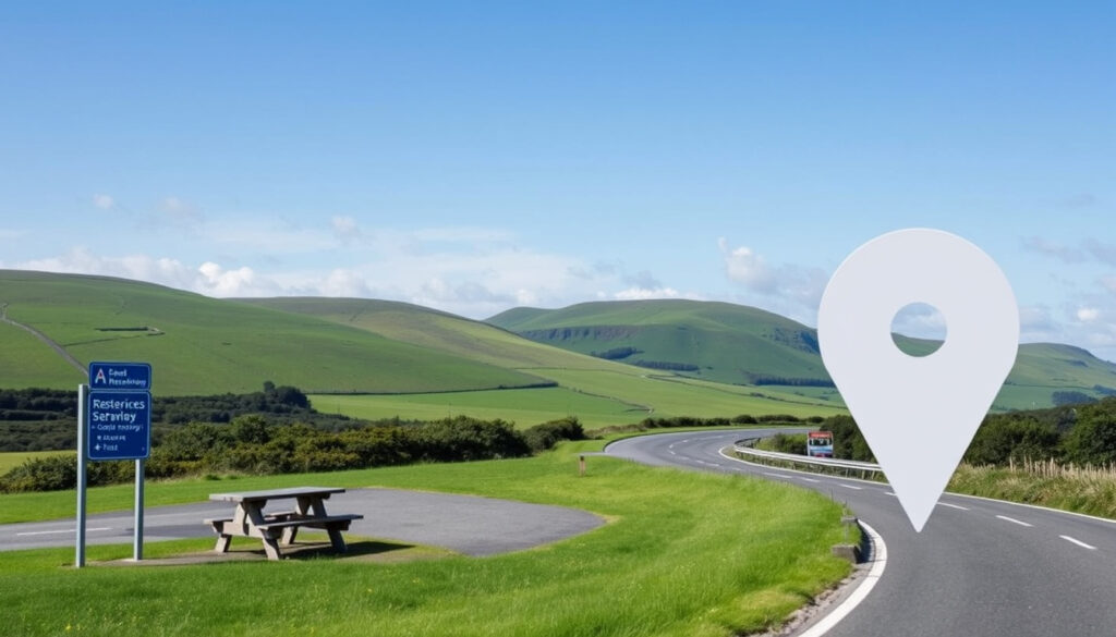
Rest Area Near Me: Google Maps Guide & Ireland Motorway Stops
Driving through Ireland without knowing where to find a break turns frustrating fast when you need one. Ireland’s motorway network has designated stops that have been expanding since the first one opened in 2010, and this guide covers how to locate them on Google Maps, a full breakdown of where they are, and what you can actually expect when you pull in.
M1 South Service Area: Lusk, near J4-J5 · M1 North Service Area: Castlebellingham, near J15-J16 · Official MSAs operated by: Transport Infrastructure Ireland · Total official TII service areas: 6
Quick snapshot
- Search “rest area near me” and filter for open locations (YouTube tutorial)
- Use pinch-to-zoom on motorway routes to spot service station icons (YouTube tutorial)
- Add stops to your route via the three-dot menu (YouTube tutorial)
- Purpose: combat driver fatigue, provide safe breaks (Wikipedia)
- In Ireland, the term used is “motorway services” or simply “services” (Wikipedia)
- Facilities include fuel, toilets, food courts, shops (Wikipedia)
- Circle K and Applegreen run the majority of Irish service areas (AARoads Wiki)
- Plaza Group operates Barack Obama Plaza, Galway Plaza, Kinnegad Plaza (AARoads Wiki)
- Junction 14 Mayfield operates 24/7/365 (Junction 14 Mayfield)
Key motorway service area locations across Ireland’s official network appear in the table below.
| Detail | Value |
|---|---|
| Primary Operator | Transport Infrastructure Ireland (TII) |
| Example Location | Lusk Service Area, M1 J4-J5 |
| North M1 Stop | Castlebellingham, County Louth, J15-J16 |
| M4 Service Area | Between Enfield and Kinnegad, J9-J10 |
| M6 Service Area | Approximately 5km east of Athlone, J7-J8 |
| M9 Service Area | 10km south of M7/M9 junction at Kilcullen, J2-J3 |
| M11 Service Area | Approximately 10km north of Gorey, J21-J22 |
| Total Official MSAs | 6 |
| First MSA Opened | Lusk Services, 8 September 2010 |
How to find a rest area on Google Maps?
Finding a rest stop has never been easier, provided you know which levers to pull in Google Maps. The app’s search and routing features are built to handle exactly this kind of mid-trip planning.
Using search for rest area near me
Start by typing “rest area near me” into the search bar. Google will return service stations and petrol stations clustered along your current location or along your planned route. Tap on any result to see whether it has parking, toilets, or food options listed. Use the “Open now” filter to discard locations that aren’t accessible at your current time.
Steps on iPhone app
Open Google Maps and enter your destination. Once directions are active, tap the three-dot menu and select “Add stop.” You can type “services” or “motorway services” to pull up recognised service areas along the route. The app will reorder your stops in the itinerary automatically. Pinch the map view while following the route to confirm the service area icon sits directly on the motorway corridor you are travelling.
Map view for nearby stops
Switch to satellite view and zoom into motorway corridors. Service stations appear as distinct pins with brand logos (Circle K, Applegreen, Supermac’s). For Ireland specifically, the Motorway Services Ireland platform provides a dedicated map showing every MSA location. You can download their data in KML format for use in Google Earth or standalone GPS units.
The implication: Google Maps is reliable for finding the nearest major stop, but the dedicated Irish database gives you a more complete picture of every service area junction-by-junction across the whole network.
Do they have rest stops in Ireland?
Yes—Ireland has a growing network of motorway service areas. The country operates six official service areas managed by Transport Infrastructure Ireland (TII), plus roughly ten additional private facilities that meet driver needs on routes where TII hasn’t built on-line stops.
Motorway service areas overview
TII provides on-line service areas on motorways as required by EU Trans-European Transport Networks (TEN-T) policy (Transport Infrastructure Ireland). On-line means the stop sits directly on the motorway corridor, accessible without leaving the main carriageway. This differs from off-line areas located at interchanges or further from the mainline.
Locations on major routes
The six official TII service areas are distributed across the key radial routes out of Dublin: the M1 south (Lusk) and north (Castlebellingham), the M4 (Enfield–Kinnegad), the M6 east of Athlone, the M9 south of Kilcullen, and the M11 north of Gorey. The M7 route alone has five official services listed on the Motorway Services Ireland database, supplemented by private operators at Moneygall (Barack Obama Plaza) and Monasterevin (Junction 14 Mayfield).
Are there service stations on Irish motorways?
Absolutely. Every major Irish motorway has service stations, though the density varies by route. The M1 between Dublin and Belfast has two TII-managed stops at Lusk and Castlebellingham, plus private operators near key junctions.
M1 service stations
The M1 South Service Area at Lusk opened on 8 September 2010, making it the first motorway service area in Ireland (Wikipedia). It sits between junctions J4 and J5 in County Dublin. Heading north, the M1 North Service Area at Castlebellingham covers junctions J15 and J16 in County Louth. Both are on-line stops, meaning you exit the motorway into the service area and re-enter without needing to leave the main carriageway at a junction.
Other routes: M4, M6, M11
The M4 Service Area sits between Enfield and Kinnegad at junctions J9 and J10—roughly halfway between Dublin and Galway. The M6 Service Area is located approximately 5km east of Athlone between junctions J7 and J8, serving the Dublin–Galway corridor. The M11 Service Area lies approximately 10km north of Gorey between junctions J21 and J22 on the route toward Wexford. Private operators like Plaza Group (Galway Plaza, Kinnegad Plaza) and Junction 14 Mayfield augment the official network on these routes.
What is the purpose of a rest area?
A rest area exists to give drivers a safe, legal place to stop before fatigue or mechanical need becomes a hazard. On motorways, stopping on the hard shoulder is dangerous and often illegal except in genuine breakdowns—so purpose-built service areas are the sanctioned answer.
Safety and driver fatigue
Driver fatigue accounts for a significant share of serious accidents on high-speed roads. Research cited in motorway safety literature consistently identifies structured breaks as a countermeasure—motorway service areas allow drivers to step away from the wheel for 15 to 20 minutes, consume food and water, and reset alertness before continuing. Ireland’s TII network was designed partly in response to EU TEN-T requirements mandating on-line rest facilities at regular intervals on major routes.
Facilities provided
Motorway service areas allow drivers to refuel, recharge (in newer stops), rest, eat and drink, shop, use the toilet, or stay in an on-site hotel (Wikipedia – Motorway service area). In Ireland, the majority of service areas contain petrol stations, truck stops, shops and fast food outlets including McDonald’s, Burger King, Subway, or Chopstix (AARoads Wiki). Junction 14 Mayfield on the M7 adds free Wi-Fi and dedicated coach parking to the standard mix.
What is another name for a rest area?
In Ireland, the term “rest area” is rarely used. The common phrasing is “motorway services” or simply “services.” Drivers and media outlets refer to “pulling into services” the way UK and Irish speakers have done for decades.
Regional terms
British English borrowed “services” from American usage, and Irish English followed suit. You’ll also hear “service station” and “motorway station” in more formal contexts. The term “rest area” appears more in official EU and US documentation than in everyday Irish road talk.
Motorway service area
“Motorway service area” is the formal designation used by TII and in Irish transport legislation. It encompasses both on-line stops (sited directly on the motorway) and off-line areas accessible via junction exits. Private operators like Circle K, Applegreen, and Plaza Group typically brand their stops with their own retail names rather than the TII formal label.
Not every Irish motorway has a TII on-line stop. The M7, for instance, has no official TII service area—the route relies on private plazas like Barack Obama Plaza at Moneygall. If you are driving the M7, you will need to actively seek private service stations rather than assuming a TII stop will appear every 30–40 minutes. If you’re looking for a rest stop on your journey, you can find Lloyds Pharmacy locations to help you locate one.
Ireland’s motorway service area network is relatively young compared to the UK or Continental Europe. The first stop opened in 2010, meaning the network is still less dense than drivers on older motorway systems may be accustomed to. Private operators have moved quickly to fill gaps, but route planning for longer journeys still benefits from checking Motorway Services Ireland before departing.
How to find a rest area near me on Google Maps — step by step
Here is the practical workflow for adding a service area stop during an active journey or while pre-planning a trip across Ireland’s motorway network.
- Open Google Maps and enter your final destination
- Tap “Directions” to activate route view
- Tap the three-dot menu and select “Add stop”
- Type “motorway services” or a known service area name (e.g., “Lusk Services”)
- Select the result that appears along your route—the map will show the new stop in your itinerary
- Toggle “Avoid tolls” or “Avoid highways” if you want to explore off-line stops at junctions
- Use the filter “Open now” to eliminate closed facilities on late-night or early-morning drives
- Check the brand logo (Circle K, Applegreen, Supermac’s) to confirm facilities expected on arrival
For a more Ireland-specific view, open Motorway Services Ireland in a separate browser tab. Their map marks every MSA with junction numbers, and you can download KML files for satellite navigation overlays.
Plaza Group – Motorway Food Stops Guide
Drivers have plenty of options across Ireland’s motorway network, but knowing where to find them before you need one makes all the difference on a long haul.
Transport Infrastructure Ireland – Motorway Service Areas
On-line service areas on motorways and high-quality dual carriageways are provided as required by EU Trans-European Transport Networks policy.
Related reading: Raw Milk Near Me in Ireland · Homes for Sale Near Me
motorwayservices.ie, tii.ie, moto-way.com, maps.google.com, google.com, motorwayservices.ie
Drivers using Google Maps for rest areas near me can cross-reference public toilet maps to locate facilities right at Ireland’s key motorway stops like M1 Lusk.
Frequently asked questions
How much does it cost to use a public restroom in Ireland?
Many motorway service area toilets operate on a pay-per-use model, typically charging €0.50–€1.00. Some newer stops have installed card-only payment for hygiene reasons. Free toilets are generally available at the facilities’ food court areas when you make a purchase.
Where are M6 service stations in Ireland?
The M6 Service Area (TII official stop) is located approximately 5km east of Athlone between junctions J7 and J8. Private operators like Galway Plaza (Plaza Group) also serve the M6 at Kiltullagh, offering food, fuel, and parking.
What facilities are at motorway service areas?
Most Irish motorway service areas offer fuel (petrol and diesel), electric vehicle charging at newer stops, toilets, food courts (McDonald’s, Burger King, Subway, Chopstix, Supermac’s), convenience shops, free Wi-Fi (at selected stops like Junction 14 Mayfield), and ample parking for cars, trucks, and coaches.
How to check if a rest area is open right now?
Use the “Open now” filter in Google Maps or check the individual service area’s website. Junction 14 Mayfield publishes 24-hour, 365-days operation. The Motorway Services Ireland database lists opening information but does not provide real-time status—verify with the specific operator before late-night travel.
Are rest areas free in Ireland?
Parking at motorway service areas in Ireland is generally free. You pay for individual services (fuel, food, toilet use) rather than the stop itself. Some private operators like Circle K may offer loyalty schemes that include free parking periods.
Best app for rest stops besides Google Maps?
Motorway Services Ireland is the most comprehensive Ireland-specific database. For longer hauls across Europe, apps like Trucker Path (covering 2,000+ locations) include Irish stops where data has been crowdsourced.
Service stations on M11 Ireland?
The M11 Service Area (TII official) is located approximately 10km north of Gorey between junctions J21 and J22. Private operators near the Gorey area also provide fuel and food services accessible via the J20 or J23 interchanges.
For drivers making regular runs across Ireland’s motorway network, the takeaway is straightforward: build your stops into the route before you need them. Use Google Maps to add services en route, or pull up Motorway Services Ireland ahead of time to map every junction and know exactly which operator is running the stop. On older routes like the M7, private plazas like Junction 14 Mayfield are your reliable fallback—and knowing they are there before the fuel gauge drops into the red zone is the real skill.
More related posts
 Supreme Court Birthright Citizenship Decision 2026: Ruling
 Magnesium Glycinate Side Effects: Safety and Dosage Guide
 Peaky Blinders Season 7: Why It’s a Movie, Finn’s Betrayal & More
 Hou e of Guinne Ca t: Full Guide to the Netflix Serie
 Cast of Nobody 2: Full List of Returning and New Actors
 Elder Scrolls Oblivion Remastered: Worth Buying? Release & Comparison
 2022 GMC Sierra 1500 Review: Price, Specs & Reliability
 Free STD Testing Near Me: Where to Get Tested in Ireland